Quick Facts
Trail Overview
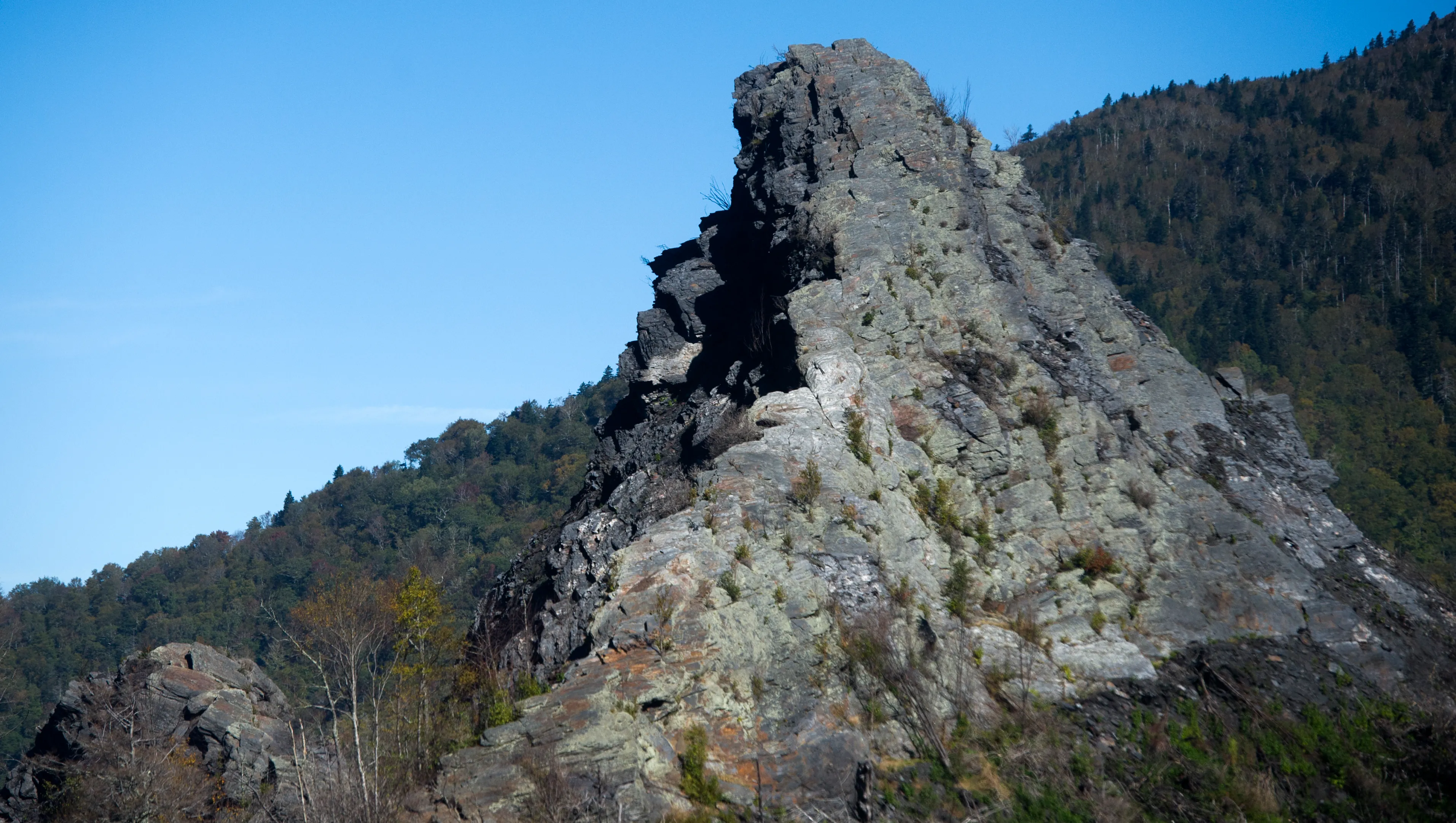
Chimney Tops Trail is one of the most beloved and challenging short hikes in Great Smoky Mountains National Park. The trail climbs steeply to a pair of distinctive rock pinnacles that rise above the surrounding forest, offering spectacular 360-degree views of the surrounding mountains. The twin rock spires are recognizable from miles away and have drawn hikers seeking panoramic views for generations.
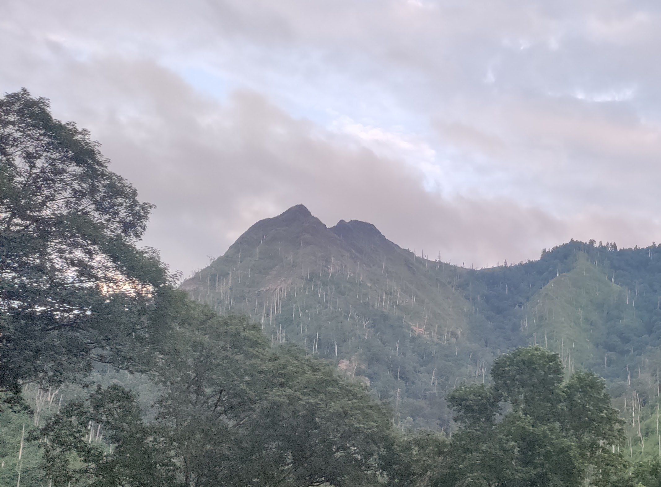
The name "Chimney Tops" comes from the twin rock spires at the summit that resemble chimneys. The Cherokee people called this peak "Duniskwalgunyi," meaning "forked antlers," a fitting description for the distinctive shape that makes this mountain instantly recognizable. Despite the relatively short 2-mile distance to the summit, this trail earns its strenuous rating through relentless climbing and rocky terrain.
Do not let the short distance fool you. Chimney Tops packs 1,400 feet of elevation gain into just 2 miles, making it one of the steepest popular trails in the park. Take your time, bring plenty of water, and plan for the hike to take longer than you might expect.
2016 Fire and Trail Changes
Important Trail Changes
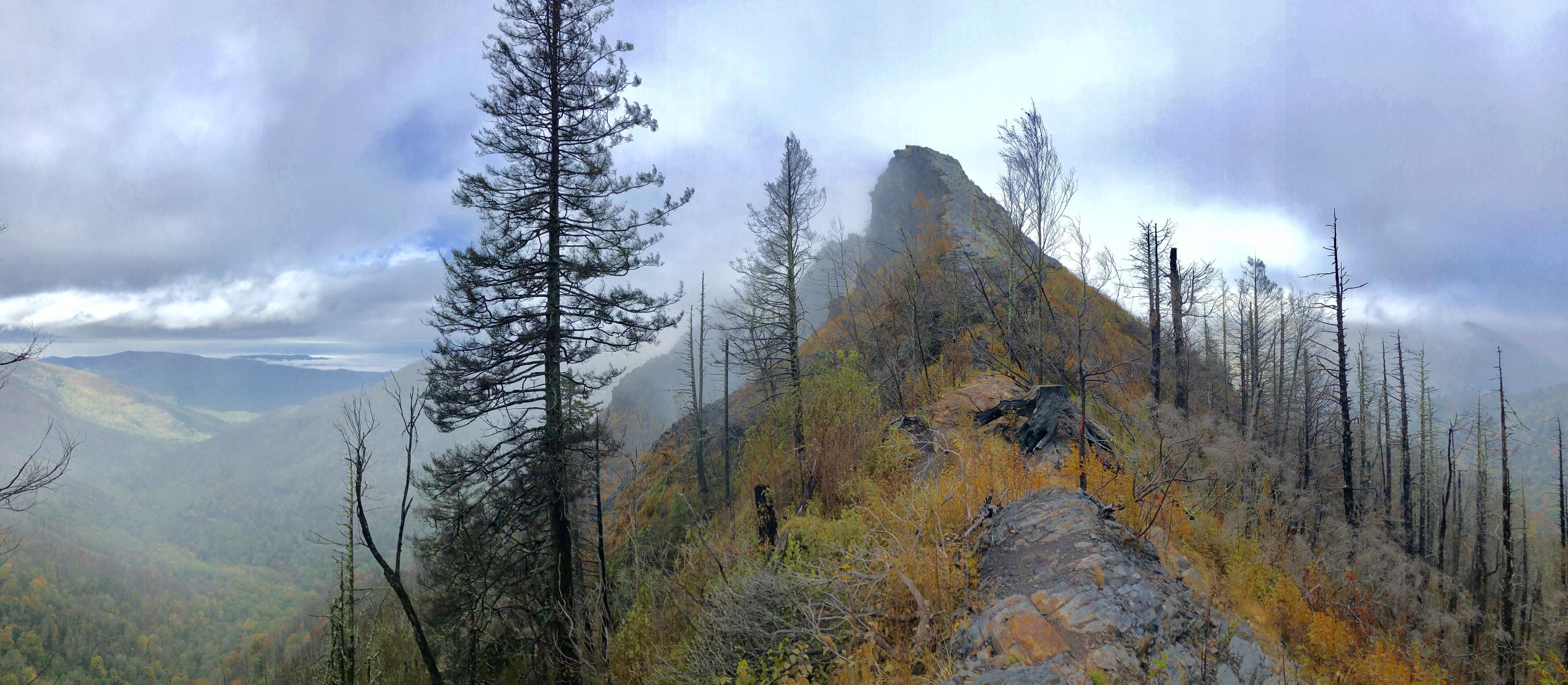
The devastating 2016 Chimney Tops 2 Fire started near this trail and burned over 17,000 acres, tragically claiming 14 lives in Gatlinburg. The trail has been restored with a new viewing platform at the end. Climbing to the very top of the rock pinnacles is now permanently prohibited for safety. The new platform still offers incredible 360-degree views.
The fire dramatically changed the landscape along this trail. Where dense forest once blocked the views, you will now see a mix of regenerating vegetation, blackened snags, and new growth. In many ways, the fire opened up views that did not exist before, though the ecological impact was significant. The forest is recovering beautifully, and hiking here today offers a unique perspective on forest regeneration.
Getting There and Parking
The Chimney Tops Trailhead is located on Newfound Gap Road (US-441), approximately 6.7 miles south of Sugarlands Visitor Center and about 8 miles from downtown Gatlinburg. There is a small parking area on the north side of the road with space for approximately 30 vehicles. The trailhead is well marked with a National Park Service sign.
Approx drive time from our cabins: 20 minutes. This makes Chimney Tops one of the most accessible challenging hikes from our Gatlinburg cabin locations.
The parking lot is small and fills by 9 AM on weekends during peak season (summer and fall foliage). For the best experience, arrive before 8 AM or visit on weekdays. If the lot is full, do not park illegally on the road shoulder as you will be ticketed. Consider Rainbow Falls or Alum Cave as alternatives.
A parking permit ($5 per day or $40 per year) is required from March through November. Permits can be purchased online through Recreation.gov or at visitor centers throughout the park.
Trail Description Mile by Mile
Mile 0 to 0.5: The Beginning
The trail begins with moderate climbing through forest that is actively recovering from the 2016 fire. You will cross Road Prong on a substantial footbridge. The regenerating forest creates unique photo opportunities with wildflowers growing among the standing dead trees.
Mile 0.5 to 1.0: Into the Forest
Climbing intensifies as the trail winds through mixed forest. The fire damage is visible but so is the remarkable recovery. Look for vibrant new growth alongside charred remnants. The contrast between destruction and regeneration is striking and offers a lesson in forest ecology.
Mile 1.0 to 1.5: Rocky Terrain
The trail becomes increasingly rocky and rooty. Beech Gap offers a brief respite before the final challenging section. Take this opportunity to catch your breath and hydrate. The sound of your destination is not audible from here, but the anticipation builds as views begin to peek through the trees.
Mile 1.5 to 2.0: The Final Push
This is the steepest section, with the final approach climbing over 700 feet in just half a mile. Rocky steps, some naturally formed and others placed by trail crews, lead upward relentlessly. The effort is worth it as you emerge at the viewing platform with the Smoky Mountains spread before you in every direction.
Planning a Hiking Trip to the Smokies?
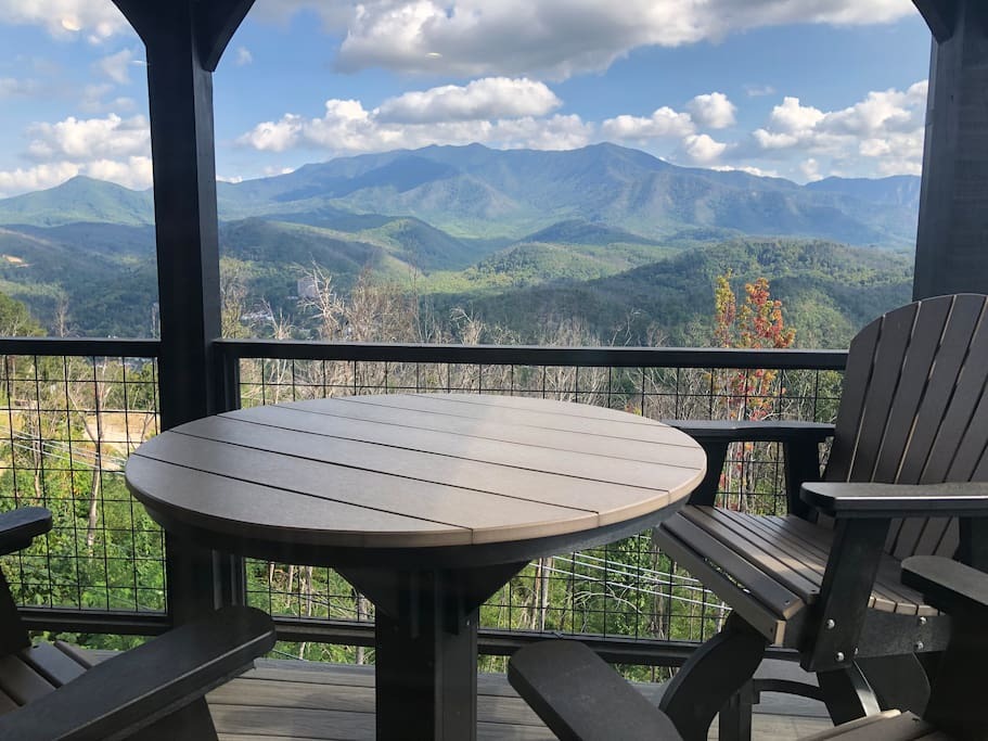
Our cabins are perfectly located just 20 minutes from the Chimney Tops trailhead. Start your hike early and return to hot tub relaxation!
Check Cabin AvailabilityWhat to Expect at the Summit
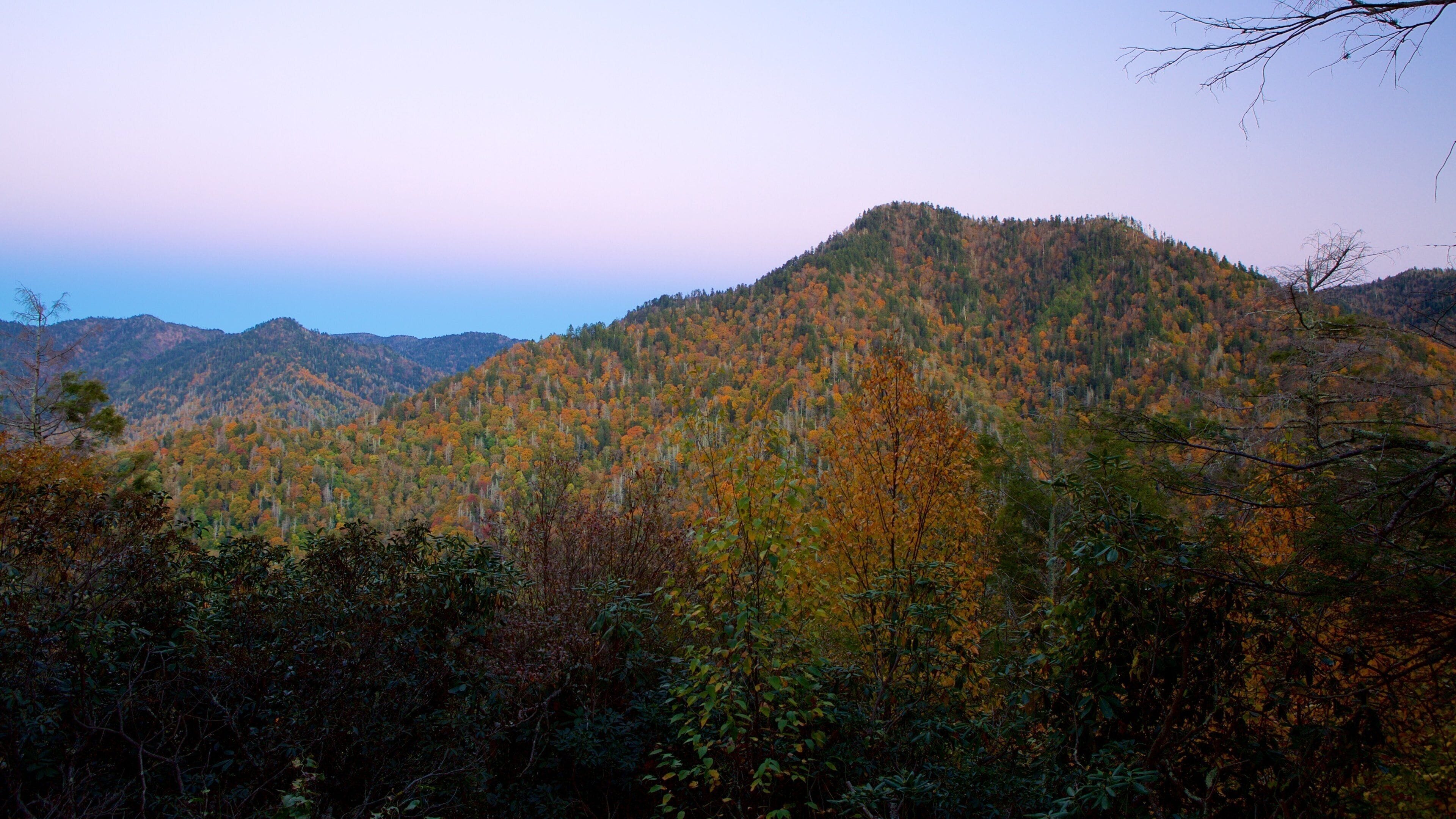
The trail now terminates at a wooden viewing platform that provides safe access to the stunning panoramic views. While you can no longer climb to the very top of the rock pinnacles (this is permanently prohibited for safety), the platform offers essentially the same spectacular 360-degree experience that has made this hike famous for generations.
On clear days, the views are extraordinary in every direction:
- North: Mount LeConte rises majestically, the third highest peak in the park
- West: Sugarland Mountain extends along the ridge
- South: The Tennessee and North Carolina border ridgeline stretches into the distance
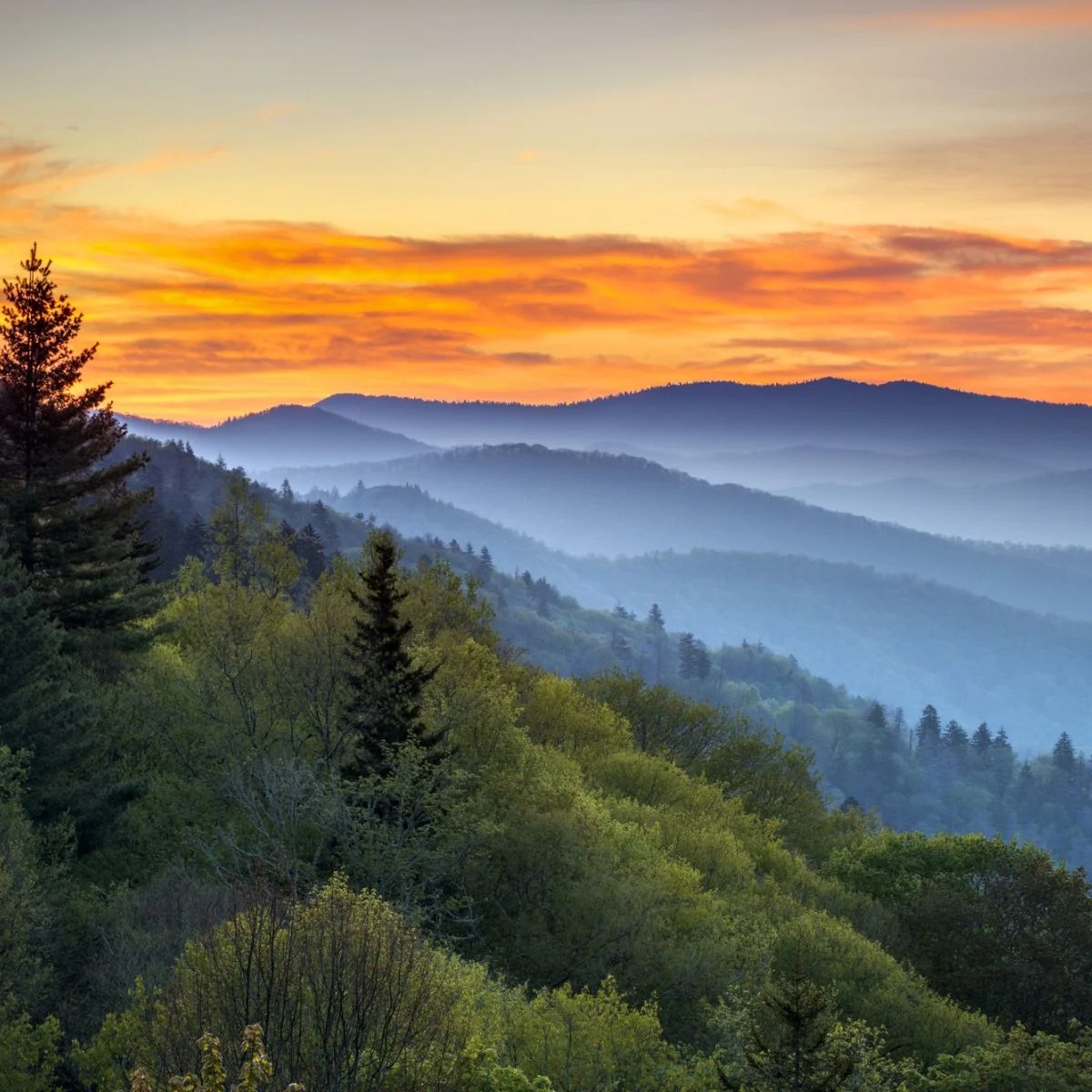
- All directions: Layer upon layer of blue mountain ridges fade into the famous Smoky Mountain haze
Early morning typically offers the clearest views before afternoon haze sets in. Fall months (October and November) provide excellent visibility plus spectacular foliage colors. The platform can get crowded midday, so early arrivals enjoy both better views and more space.
Difficulty Assessment
This trail is genuinely difficult and earns its strenuous rating. The 1,400 feet of elevation gain in just 2 miles means you are climbing steeply almost the entire way. The trail surface is often rocky and requires careful footing. However, if you are in reasonable physical condition and take your time, it is very achievable for most healthy adults.
This hike is ideal if you:
- Are comfortable hiking uphill for extended periods
- Have good hiking shoes with ankle support and grippy soles
- Want a challenging but relatively short hike that can be completed in half a day
- Seek spectacular views without committing to an all-day hiking adventure
- Have experience with steep terrain and do not mind rocky trails
This may not be the best choice if you:
- Are new to hiking or have limited cardiovascular fitness
- Are hiking with young children or those with limited mobility
- Have knee problems, as the descent can be hard on the joints
- Prefer flat or gently graded trails
What to Bring
- Water: At least 2 liters per person. You will be sweating on this steep climb.
- Sturdy hiking shoes: The rocky trail demands good footwear with ankle support
- Layers: It can be significantly cooler and windier at the summit
- Trekking poles: Extremely helpful for both the climb and especially the steep descent
- Snacks: Energy foods to fuel your climb
- Camera: The views are spectacular and you will want to capture them
- Sunscreen and hat: The viewing platform is fully exposed to the sun
- Rain jacket: Weather can change quickly at elevation
Best Times to Hike
- Early morning: Beat the heat and crowds while enjoying the best visibility
- Fall (October and November): Peak foliage and clearer skies make this the ideal season
- Late spring (May): Wildflowers and comfortable temperatures
- Weekdays: Fewer crowds on the trail and easier parking
Avoid hiking in afternoon summer thunderstorms. The exposed summit platform is dangerous in lightning. Always check weather forecasts before heading out, and be prepared to turn back if conditions deteriorate.
Nearby Trails to Explore
If you enjoyed Chimney Tops or are looking for alternatives, consider these nearby trails:
Approx Drive Time from Our Cabins
| Location | Drive Time |
|---|---|
| Our Cabins to Chimney Tops Trailhead | Approx 20 minutes |