Quick Facts
The Story Behind the Name
Charlies Bunion gets its unusual name from a 1929 hiking trip that has become part of Smoky Mountains lore. Charlie Conner, a prominent Knoxville businessman and hiking enthusiast, was trekking along this ridge with writer and conservationist Horace Kephart when he removed his boots to reveal severely bunioned feet. Kephart looked at the rocky outcrop rising before them - a gnarled, bulging mass of exposed stone - and declared it looked just like Charlie's bunion. The colorful name stuck, and nearly a century later, hikers still smile when they learn the origin story.
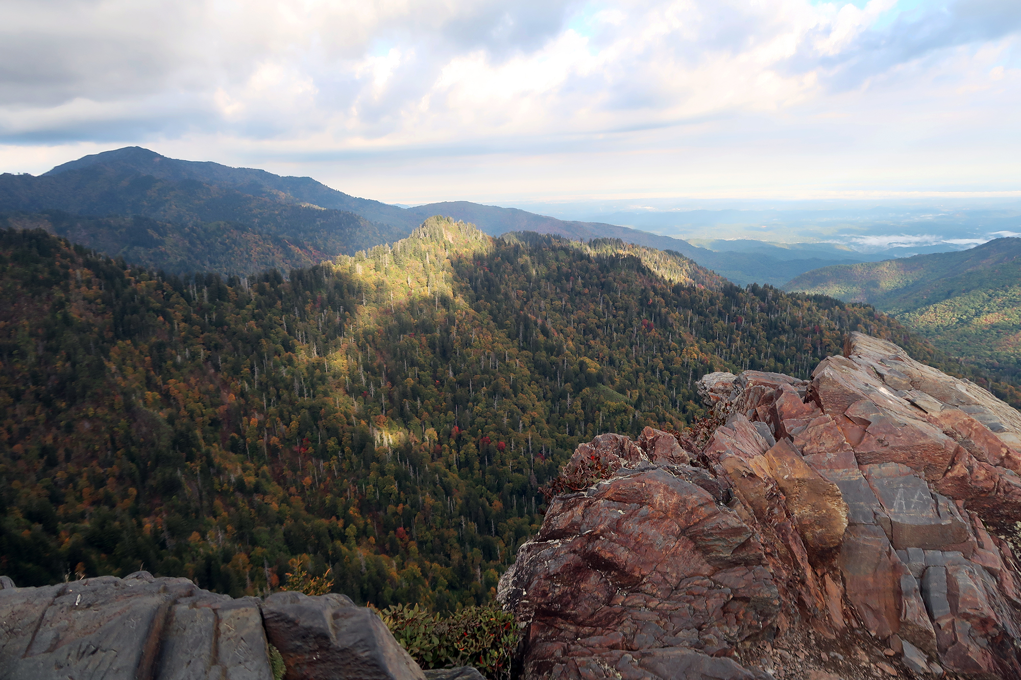
The rocky prominence itself was created by a devastating 1925 fire followed by a 1929 cloudburst that stripped away the soil from the ridge, exposing the bare metamorphic rock we see today. What was once forested mountaintop is now a dramatic rocky viewpoint offering some of the most spectacular scenery in the Smokies. Nature's destruction created one of the park's most beloved destinations.

This hike follows the famous Appalachian Trail northbound from Newfound Gap. You are literally walking the same path that thru-hikers take on their 2,190-mile journey from Georgia to Maine. You might even meet some of them along the way - look for the unmistakable look of trail-worn determination and oversized backpacks.
Getting There from Newfound Gap
The hike to Charlies Bunion begins at Newfound Gap, one of the most accessible high-elevation points in the park. Newfound Gap is located on US-441 (Newfound Gap Road), approximately 15 miles south of Gatlinburg and 20 miles north of Cherokee, North Carolina. The large parking lot straddles the Tennessee-North Carolina state line at an elevation of 5,048 feet.
Approx drive time from our cabins: 30 minutes. The drive to Newfound Gap is scenic and worthwhile in itself, climbing through forest and offering increasingly impressive views as you gain elevation.
Parking Information
- Lot size: Large parking area that rarely fills completely
- Parking permit: Not required at Newfound Gap
- Restrooms: Available at the parking area
- Visitor information: Interpretive signs at the state line marker
- Elevation: You start at 5,048 feet, so dress for cool temperatures
Trail Description on the Appalachian Trail
From the Newfound Gap parking area, look for the Appalachian Trail marker on the north side of the lot. The trail is well marked with the iconic white blazes that guide hikers along the entire 2,190-mile route from Georgia to Maine.
Mile by Mile Breakdown
- Miles 0 to 1.7: Gentle but steady climbing through spruce-fir forest along the state line ridge. The trail is well maintained with moderate grades. You are walking at elevations above 5,000 feet through one of the southernmost spruce-fir forests in the world.
- Mile 1.7: Boulevard Trail junction. Stay on the Appalachian Trail (continue straight) rather than turning onto the Boulevard Trail which leads to Mount LeConte Lodge.
- Miles 1.7 to 2.7: Trail becomes more rugged as it traverses the ridgeline. Views begin opening up through gaps in the trees. The character of the hike changes as you leave the dense forest behind.
- Mile 2.7: The Jumpoff side trail junction. This dramatic viewpoint is worth the 1-mile round trip detour if you have time and energy (more details below).
- Miles 2.7 to 4.0: Final approach to Charlies Bunion through heath balds and exposed ridgeline. The views intensify with each step as the full panorama reveals itself.
- Mile 4.0: Charlies Bunion. Prepare to be amazed.
Planning an Appalachian Trail Adventure?
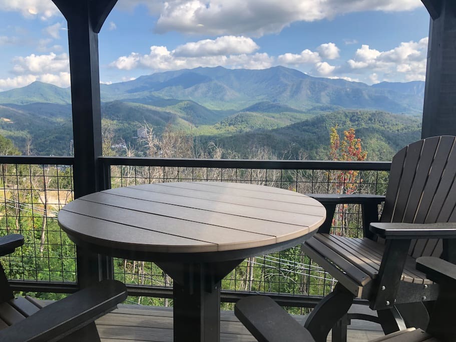
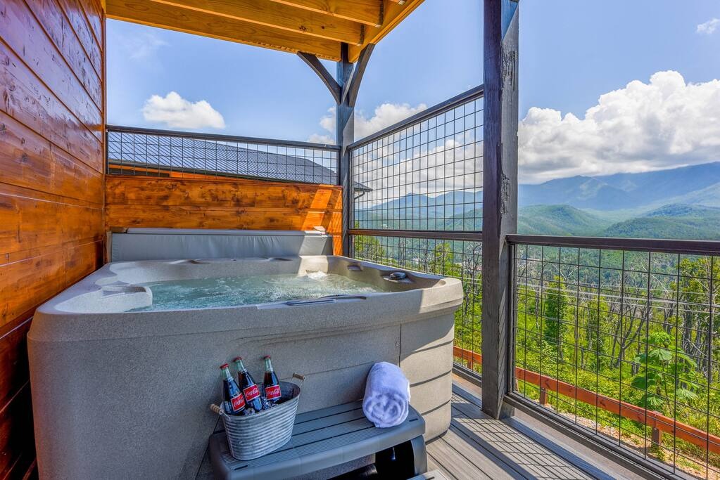
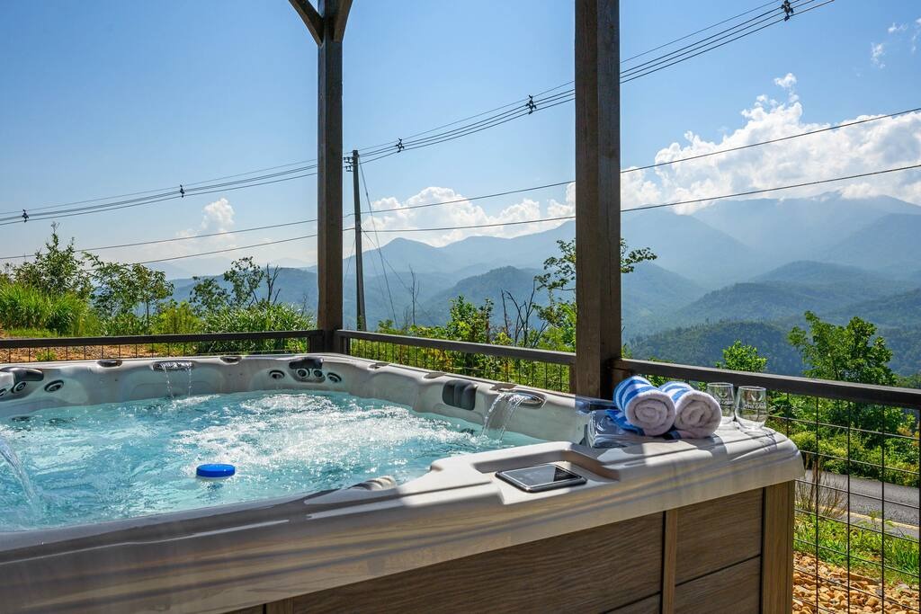
Our Gatlinburg cabins put you just 30 minutes from Newfound Gap. Start your AT section hike early and return to hot tub relaxation!
Check Cabin AvailabilityAt Charlies Bunion
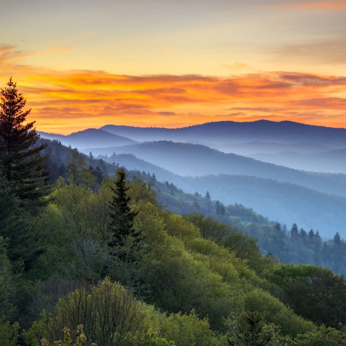
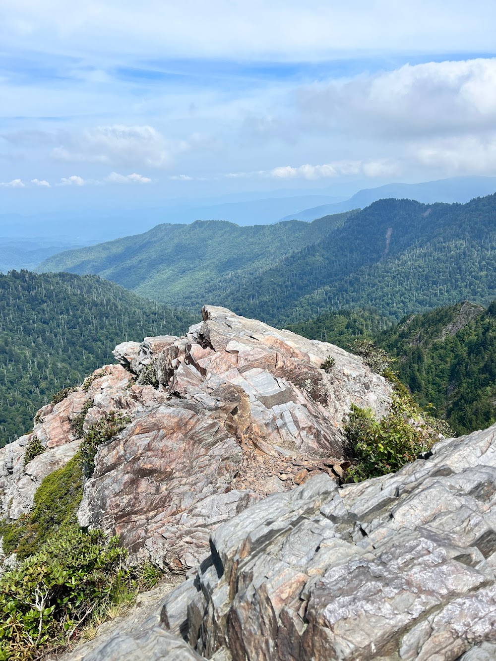
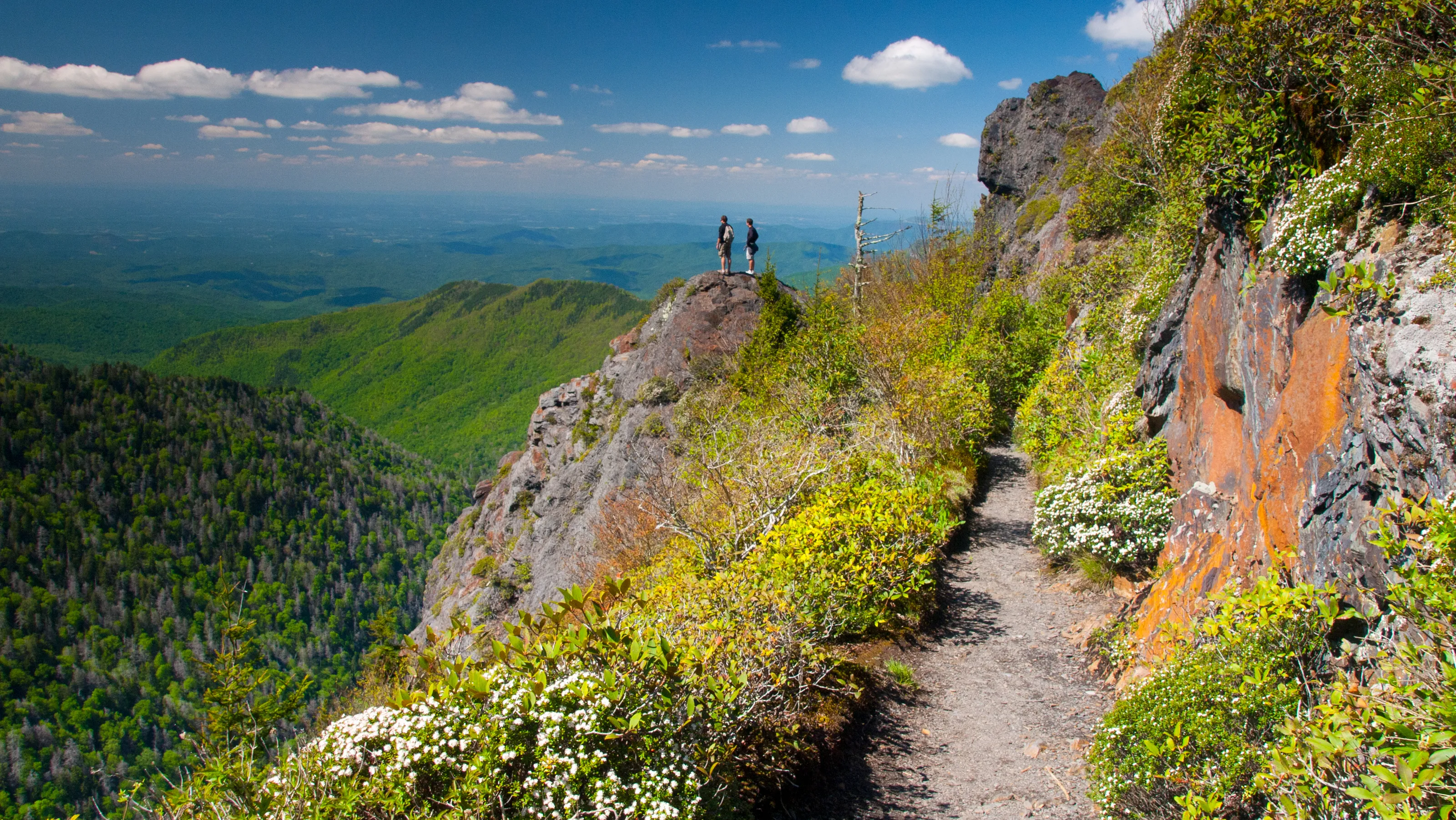
The rock outcrop at Charlies Bunion offers vertiginous views straight down into North Carolina. The exposed rock face drops away dramatically, with nothing but air between you and the valley floor far below. On clear days, visibility can exceed 50 miles in multiple directions. The panorama of overlapping mountain ridges fading into the distance is classic Smoky Mountains scenery at its finest.
Extreme Caution Required
Charlies Bunion has sheer drop-offs with no protection. There are no railings, no barriers, and no safety features. People have died here. Stay well back from edges, especially when it is windy. Keep children and pets under very close control. Do not attempt to climb down the rock faces or approach the edge for photos. The views are spectacular from safe distances.
The exposure at Charlies Bunion is both its greatest attraction and its greatest danger. The sense of being suspended in space above the valley is exhilarating, but only if you respect the mountain. Find a safe spot, sit down, and take in the view. There is no need to approach the edge for an adequate experience of this remarkable place.
Adding The Jumpoff
If you have the time and energy, take the 1-mile round trip side trail to The Jumpoff viewpoint at mile 2.7. The views are equally dramatic to Charlies Bunion but from a different perspective. This adds approximately 30 to 45 minutes to your total hiking time but rewards you with another stunning overlook.
The Jumpoff offers a straight-down view into the Greenbrier watershed. Like Charlies Bunion, the overlook has no barriers and requires extreme caution. However, for view collectors and photographers, hitting both viewpoints in one hike makes for an exceptional day in the Smokies.
What to Expect
- High elevation environment: Expect temperatures 15 to 20 degrees Fahrenheit cooler than Gatlinburg. The starting elevation is already over 5,000 feet.
- Exposure: Much of the trail follows an exposed ridge. Bring sun protection, rain gear, and wind layers regardless of conditions in town.
- Rocky terrain: The trail is rooty and rocky in places. Sturdy hiking boots are strongly recommended.
- Possible crowds: This is a popular hike. Expect to share the trail and viewpoint with other hikers, especially on weekends and during fall foliage season.
- Weather changes: Conditions can change rapidly at high elevation. Be prepared to turn back if storms develop.
- AT thru-hikers: You may encounter Appalachian Trail thru-hikers. They generally appreciate trail magic (snacks, water) and kind words of encouragement.
Best Times to Visit
- Clear days: Visibility can exceed 50 miles on crisp, clear days following weather fronts
- Fall (October and November): Spectacular foliage views and cooler hiking temperatures make this the ideal season
- Early morning: Fewer crowds and often clearer visibility before afternoon haze develops
- Late spring (May): Wildflowers along the trail and comfortable temperatures
- Weekdays: Significantly fewer hikers than weekends
Avoid hiking here in storms. The exposed ridge is extremely dangerous in lightning. Check weather forecasts before heading out and be willing to postpone your hike if conditions are unfavorable.
What to Bring
- Wind layers: The ridge can be very windy even on calm days in the valley
- Warm layers: Temperatures are significantly cooler at elevation. Bring more than you think you need.
- Water and snacks: There are no water sources on the trail. Carry at least 2 liters per person.
- Sun protection: Exposed ridgeline hiking means direct sun exposure
- Camera: The views demand documentation
- Sturdy hiking boots: The rocky, rooty trail requires good footwear
- Rain gear: Weather can change quickly at high elevation
- Trekking poles: Helpful on the rocky sections and steep grades
Approx Drive Time from Our Cabins
| Location | Drive Time |
|---|---|
| Our Cabins to Newfound Gap Trailhead | Approx 30 minutes |