Quick Facts
In This Guide
Trail Overview
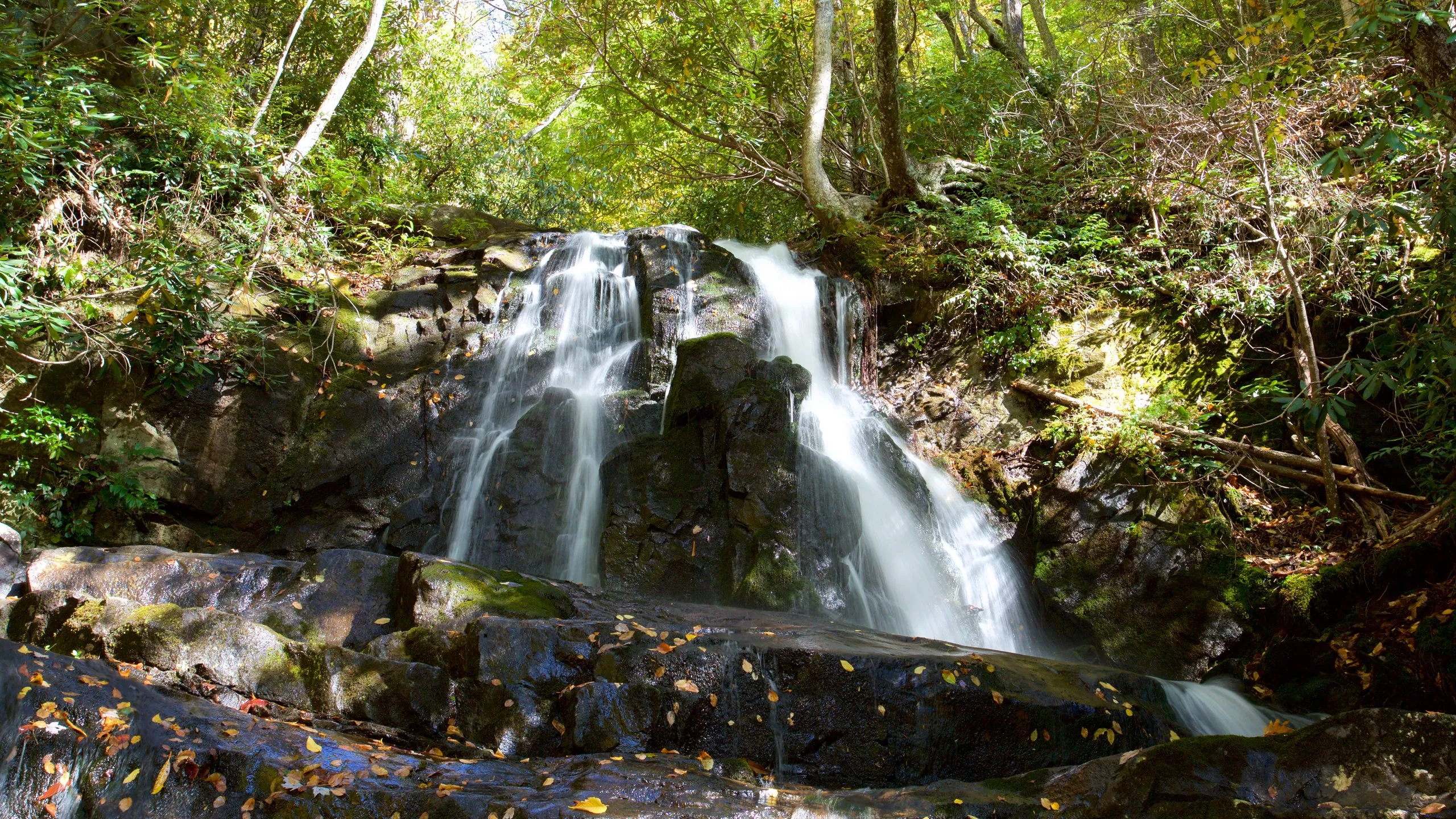
Laurel Falls is the most visited waterfall in Great Smoky Mountains National Park, and for good reason. The spectacular 80-foot waterfall cascades in two distinct tiers over a rocky ledge, creating one of the most photogenic scenes in the Smokies. What makes this trail particularly special is that it remains accessible to hikers of nearly all fitness levels thanks to its paved surface.
Located just 15 minutes from downtown Gatlinburg and our luxury cabin rentals, Laurel Falls has been drawing visitors since the trail was paved in the 1930s by the Civilian Conservation Corps. Today, it welcomes hundreds of thousands of visitors annually, making it an essential Smoky Mountain experience for families, casual hikers, and photography enthusiasts alike.
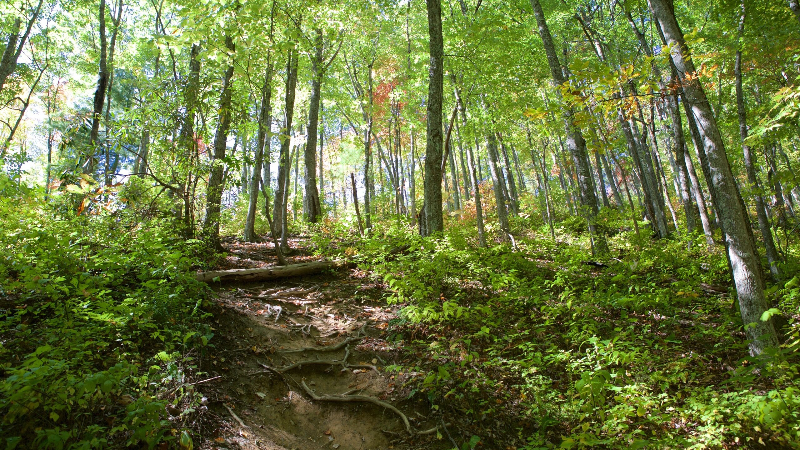
The trail climbs steadily but gently through a magnificent forest of pine, oak, and mountain laurel. The mountain laurel blooms spectacularly in late May and early June, transforming the trail into a corridor of pink and white blossoms. At 1.3 miles, you will reach the falls, where a historic stone bridge crosses the stream at the midpoint of the cascade, offering excellent views of both the upper and lower falls.
For the best experience, arrive before 8 AM to secure parking and enjoy the falls with fewer crowds. The morning light filtering through the forest canopy creates magical conditions for photography. Our guests often grab coffee from the cabin and hit the trail early, returning for a leisurely breakfast afterward.
Getting There and Parking
The Laurel Falls Trailhead is located on Little River Road (also called Fighting Creek Gap Road), approximately 3.8 miles west of Sugarlands Visitor Center. From downtown Gatlinburg, the drive takes about 15 minutes. From any of our cabins near downtown Gatlinburg, you can reach the trailhead in 10-20 minutes depending on your location.
Parking presents the biggest challenge for this popular hike. The small parking lot fills quickly, often by 8 AM on weekends and by 9 AM on weekdays during peak season (June through October). Additional overflow parking exists along the road, but this fills up too. Rangers actively ticket illegally parked vehicles, so plan accordingly.
Parking Permit Required
As of 2023, a parking tag ($5 per day or $40 annually) is required at this trailhead from March through November. Purchase online at recreation.gov or at park visitor centers before you arrive. Enforcement is strict, and the lot fills quickly.
Parking Strategy Tips
- Arrive by 7:30 AM on weekends or 8:30 AM on weekdays during peak season
- Visit on a weekday if your schedule allows for fewer crowds and easier parking
- Consider off-season visits in late fall or early spring when crowds diminish significantly
- Never park illegally along the road in non-designated areas. You will be ticketed or towed.
- Have a backup plan such as Grotto Falls or Rainbow Falls if the lot is full
Planning a Hiking Trip to the Smokies?
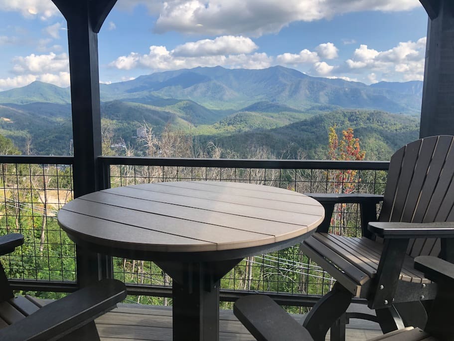
Our cabins are perfectly located for early morning trailhead access. Wake up, grab coffee, and beat the crowds!
Check Cabin AvailabilityWhat to Expect on the Trail
The trail is entirely paved with asphalt, though the pavement can be uneven in places with some exposed roots and rocks. The Civilian Conservation Corps built this trail in the 1930s, and while it has been maintained over the decades, the mountain terrain has shifted the surface in spots. Wear sturdy walking shoes or hiking boots with good grip rather than sandals or flip-flops.
The grade is moderate but steady uphill for the entire 1.3 miles to the falls. While technically accessible, the grade may be challenging for wheelchairs or strollers without assistance. The trail width allows hikers to pass each other comfortably in most sections.
Trail Highlights Mile by Mile
- Mile 0.0: Trailhead with restrooms available (vault toilets)
- Mile 0.3: Trail enters beautiful mountain laurel groves
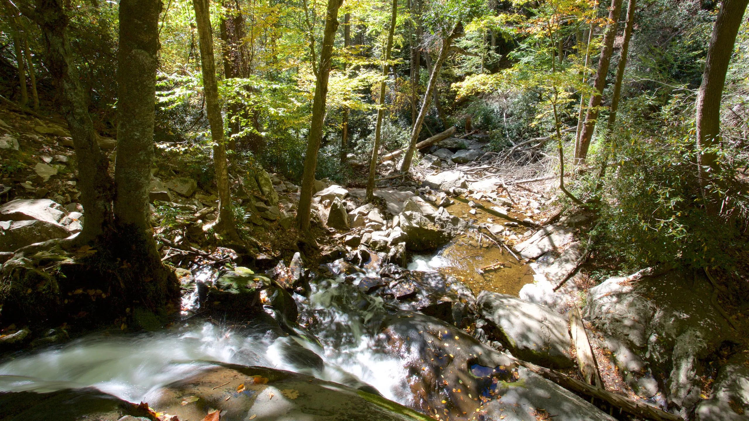
- Mile 0.5: Cross a small wooden footbridge
- Mile 0.8: Nice overlook views of the valley through the trees
- Mile 1.0: You will start to hear the falls in the distance
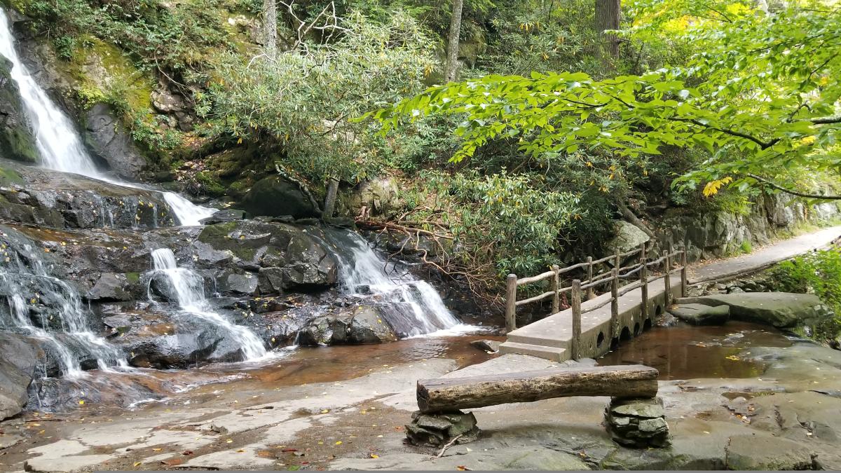
- Mile 1.3: Arrive at the historic stone bridge crossing Laurel Falls
Best Time to Visit
Arrive before 8 AM to find parking and avoid crowds. The falls are most impressive after recent rainfall. Late May and early June offer beautiful mountain laurel blooms along the trail. Winter can bring ice formations on the falls, creating beautiful but slippery conditions.
At the Falls
The waterfall is split into two distinct tiers by the stone bridge crossing. The upper falls drop about 60 feet in a sheer cascade, while the lower falls continue another 20 feet below the bridge. The total drop of approximately 80 feet makes it one of the taller accessible waterfalls in the entire national park.
The bridge offers the best viewing angles and photo opportunities. From here you can see both tiers of the falls, and the mist creates a cooling effect on warm summer days. Take your time to appreciate the power of the water, especially if visiting after a recent rain when the flow intensifies dramatically.
Safety Warning
Do not climb on the rocks around the waterfall. They are deceptively slippery even when they appear dry. Several people have died after falling on these rocks. The best views are from the bridge and designated viewing areas. Keep children close at all times and stay behind safety barriers.
If you want to continue hiking beyond the falls, the trail extends another 4 miles to Cove Mountain Fire Tower. This continuation becomes significantly more difficult, climbing steeply on an unpaved trail with rocky terrain. Most visitors wisely turn around at the falls, making the round trip a manageable 2.6 miles.
Photography Tips
Laurel Falls rewards photographers willing to put in a bit of effort to get the best shots. The combination of cascading water, lush forest, and the historic stone bridge creates endless compositional opportunities.
- Best light: Early morning or overcast days to avoid harsh shadows on the white water
- Bring a polarizer: Cuts glare on the water surface and enhances the green foliage colors
- Slow shutter speeds: Use a tripod for silky water effects (1/4 second or longer works well)
- Frame with laurel: The mountain laurel makes beautiful foreground elements in late May
- Both tiers: Shoot from the bridge to capture the full cascade, or focus on each tier individually
- Arrive early: Morning light streaming through the forest creates magical rays and fewer tourists in your shots
What to Bring
Packing the right items will make your Laurel Falls hike more enjoyable. Even though this is a short, paved trail, come prepared:
- Water (at least one bottle per person)
- Sunscreen and hat (limited shade on parts of the trail)
- Camera or smartphone for photos
- Layers (mountain temperatures can vary significantly)
- Comfortable walking shoes or hiking boots with good grip
- Parking permit (purchased in advance from recreation.gov)
- Snacks for the trail
- Rain jacket (weather changes quickly in the mountains)
Nearby Attractions
After your hike, the Little River Road area offers several other activities to round out your day in the park:
- Sugarlands Visitor Center: Just 4 miles away, featuring exhibits on park history and wildlife plus ranger programs
- Downtown Gatlinburg: 15 minutes away for dining, shopping, and attractions like Ripley's Aquarium
- Elkmont Historic District: Historic cottages and picnic areas nearby
- Little River: Excellent swimming holes and wading spots along the road
- Grotto Falls: Another beautiful waterfall hike, 45 minutes away
Approx Drive Time from Our Cabins
| Location | Drive Time |
|---|---|
| Our Cabins to Laurel Falls Trailhead | Approx 15 minutes |